WOLF CREEK RESEARCH BASIN
  • Home
  • About
  • Current Projects
  • Partners
  • Share with us
  • Data
    • Real Time Data
    • Historical Datasets
    • Publications
  • History
  • Contact

About WCRB

About

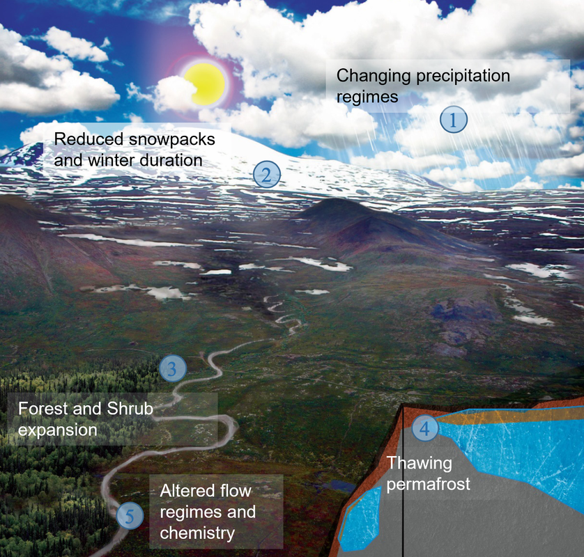
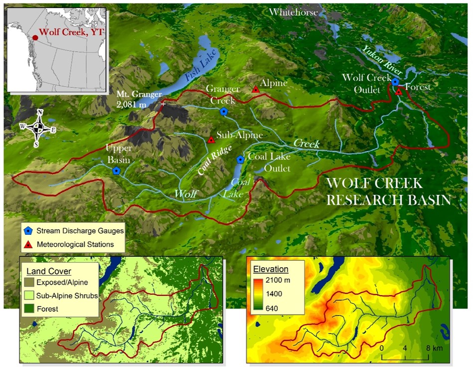
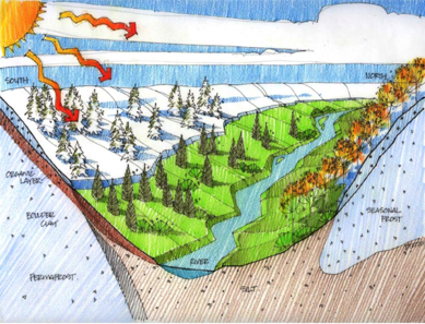
Wolf Creek Research Basin (WCRB) is located on the traditional territory of the Kwanlin Dün First Nation, Ta’an Kwäch’än Council and Carcross/Tagish First Nation. In 1992, the WCRB was established in the sub-Arctic mountainous headwaters of the Yukon River, near Whitehorse, Yukon, Canada and is representative of many headwater basins along the far northern reaches of the North American Cordillera. WCRB was established to provide science-based evidence for decision-making in the across of water, climate and the biosphere and to provide a test-bed to help resolve deficiencies in hydrological models in cold climates. The foundation of research in WCRB is to improve the understanding of cold region hydrological processes and their interaction with climate and vegetation and to better represent this understanding through improved conceptualization and parametrization of numerical hydrological and related models.
Picture
"Wolf Creek has grown through the years, and is now a place where people from around the world come to look for answers as to how climate change will impact the north." - Dr. Sean Carey

Characteristics and Instrumentation

  • Southern Yukon, Canada
  • 60.5oN, 135oW.
  • 176 km2 with three distinct ecozones. Elevation 640 to 2100 masl. 
  • Headwater of Yukon River
  • Subarctic climate (DFc). 
  • Temperatures range from -1oC to -4oC. 
  • Precipitation ranges from 250-400 mm depending on elevation with strong phase implications.  
  • White spruce aspen forests transitioning to shrub tundra and alpine vegetation.
  • Complex geology and glacial history. Thick till deposits. 
  • Sporadic permafrost at high elevation and north-facing slopes.
  • Four long term hydrometric gauges.
  • Water quality sondes at two sites.
  • Four long term meteorological station in each ecozone.
  • Three eddy covariance stations.
  • Multiple instruments for inter-comparison (for example, snow is measured with 9 distinct instruments at one site). 
  • Several shallow wells and two deep groundwater wells. 
  • Year-round measurements now available due to two-full time technical staff on-site.
Picture
Picture

​Wolf Creek Research Basin is located in the traditional territories of the Kwanlin Dün First Nation, Ta’an Kwäch’än Council and Carcross/Tagish First Nation
© COPYRIGHT 2015. ALL RIGHTS RESERVED.
  • Home
  • About
  • Current Projects
  • Partners
  • Share with us
  • Data
    • Real Time Data
    • Historical Datasets
    • Publications
  • History
  • Contact